.png)

A sustainable world where ecological information is available and accessible to anyone
To achieve our vision, "a sustainable world where ecological information is available and accessible to anyone", we work at multiple topics across a range of scales with diverse sensing tools.
Our Research


Global
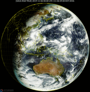
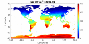
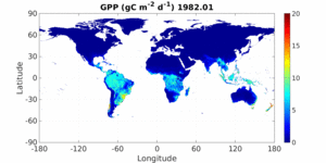
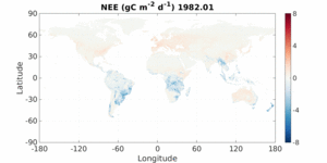
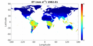
We monitor canopy structure and functions at global scale using Breathing Earth System Simulator (BESS) forced by multiple satellite remote sensing datasets


Urban
We count, quantify, position, characterize all trees at city scale


Forest
We monitor forest carbon and water cycles


Crop
We monitor crop growth status from leaf to the global crop lands


Yan, Y., & Ryu, Y. (2021). Exploring Google Street View with deep learning for crop type mapping. ISPRS Journal of Photogrammetry and Remote Sensing, 171, 278-296.

Dechant, B., Ryu, Y., Badgley, G., Köhler, P., Rascher, U., Migliavacca, M., ... & Berry, J. A. (2020). NIRvP: a robust structural proxy for sun-induced chlorophyll fluorescence and photosynthesis across scales.

Sensing Network
We develop spectral sensors and install them across diverse ecosystems towards spectral sensing network


